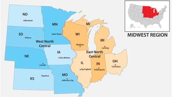
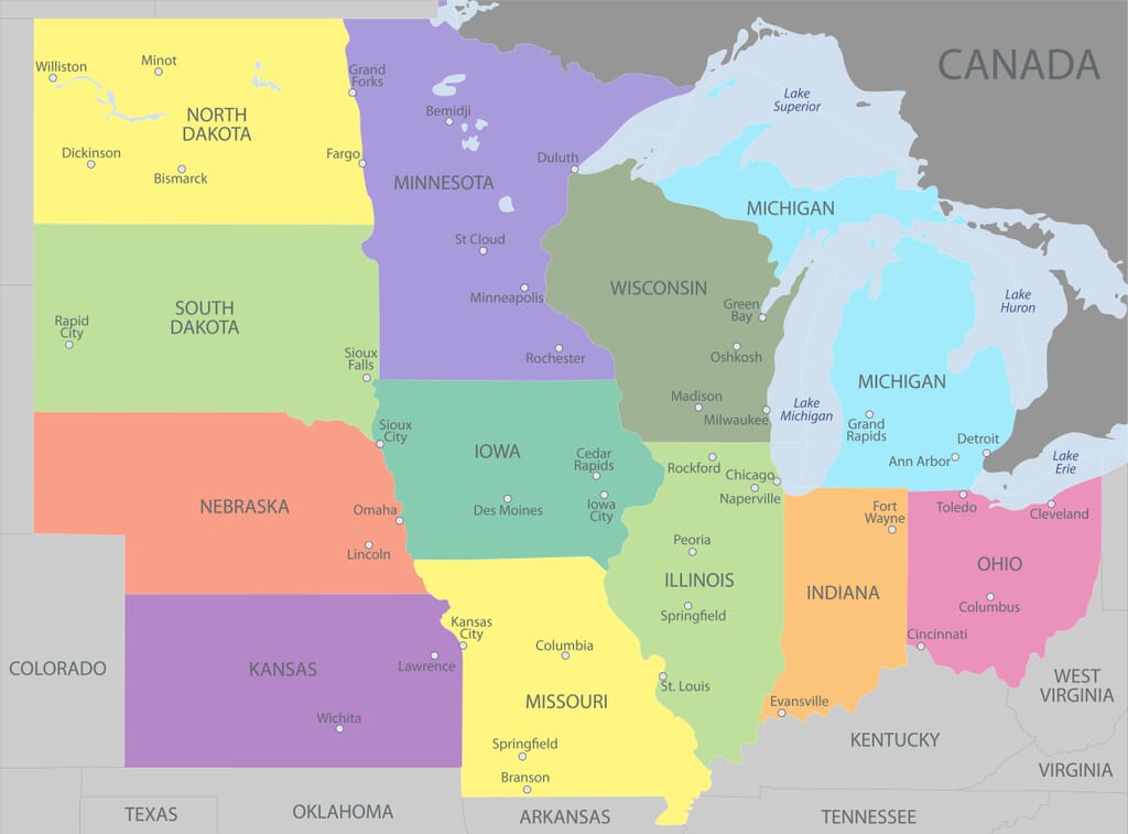
The Midwestern United States is a region designated by the US Census Bureau in the northern central part of the country. There are 12 states that belong to this region that borders Canada, the Western, Northeastern, and Southern United States. The region is also sometimes referred to as “The Midwest” or “The American Midwest.”
States in the Midwest:
The name for this region could be misleading, as the region extends more to the east of the center of the country than the west. This reason for this is related to the country’s history of expansion westward as it grew.
The Midwestern US is also sometimes referred to as “America’s Heartland.” It plays an important role in the farming and manufacturing sectors that contribute to the country’s economy. The region also contains small towns as well as large cities, representing a wide range of the country’s population.


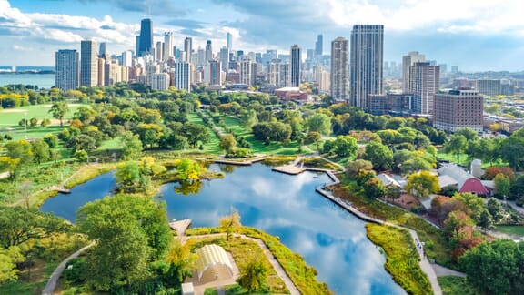
Illinois is a state in the eastern half of the US Midwest. It is a major transportation hub given its central location and access to various bodies of water. It borders Lake Michigan and five other states.
The largest and most populous city in Illinois is Chicago, which is the third-most populous city in the country and the most populous in the Midwest. The city is widely known as “The Windy City” and is notable for its music scene and urban planning.
The capital city of Illinois is Springfield, and the state was the 21st to join the USA in 1818. The French were the first European settlers to arrive in the area, and it had been inhabited by indigenous populations for thousands of years prior.
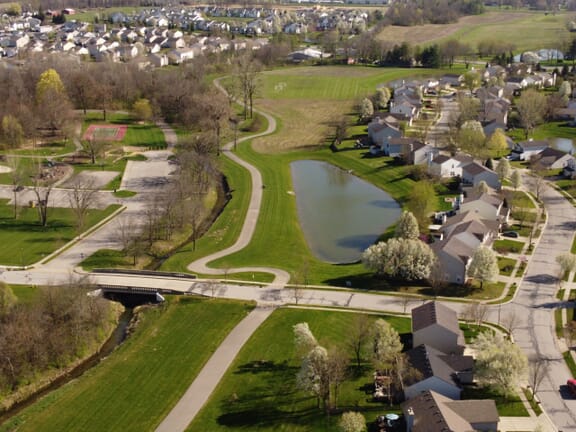
Indiana is a Midwestern state that borders Lake Michigan, Michigan, Ohio, Kentucky, and Illinois. The state’s name comes from the fact that there was still a high population of “American Indians,” or indigenous peoples, after it acquired statehood.
Indiana is part of the Great Lakes Region by virtue of its coastline on Lake Michigan, and there is a great deal of suitable farmland in the state. The central and northern parts of the state are mostly flat, and there are some hills and valleys in its southern region.
The capital city of Indiana is Indianapolis, known also as “Indy” and is the largest city in the state. The world’s largest single-day sporting event, the Indianapolis 500, is held here every year.
Indigenous peoples have inhabited the area of Indianapolis since as early as 10,000 BCE.
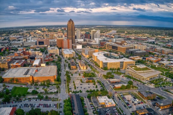
Iowa is a state in the center of the Midwestern United States. It is bordered by seven other states, and its capital city is Des Moines, which is also the largest in the state. Iowa joined the USA as the 19th state in 1846.
Situated between two rivers, Iowa is bordered by the Mississippi River to the east and the Missouri River and Big Sioux River to the west. A small portion of its southern border is defined by the Des Moines River.
A large proportion of the state is used for agriculture, as 60% of its land is dedicated to crop production. Another 30% is covered by grasslands, and forests make up 7%. Several natural lakes can be found in the state, as can various man-made lakes.
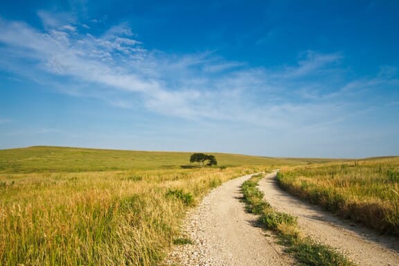
Kansas is a landlocked state in the Midwestern United States that gets its name from the Kansas River. The river was named for the Kansa people who lived along its banks before the arrival of European settlers. Kansas became the 36th state to join the USA in 1861.
There are hills and forests in the eastern third of the state, but the rest of Kansas is made up of mostly flat terrain and plains. It is a common misconception that it is the flattest state in the country, which is Florida.
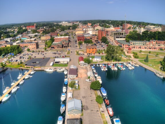
Total Land Area: 250,493 km 2 (96,716 mi 2 )
2022 Population Estimate: 10,032,720
Michigan is located in the Great Lakes Region of the American Midwest. It borders Lake Superior, Lake Michigan, Lake Erie, and Lake Huron.
The only state in the USA to feature two peninsulas, Michigan has the highest amount of freshwater coastline of any political subdivision in the world. Second only to Alaska, Michigan has the most water within its borders of any state — more than 60,000 ponds and lakes.
Before becoming the 26th state to join the USA in 1837, the area of present-day Michigan was part of the Northwest Territory, the Indiana Territory, and then the Michigan Territory. Border disputes with Canada lasted until after the War of 1812.
Detroit is the largest city in Michigan, and it is known for being the center of the US automotive industry since the early 20th century. The capital city of Michigan is Lansing.
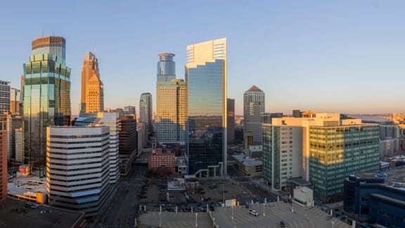
Minnesota is a state in the Midwestern United States that borders Canada, North Dakota, South Dakota, Iowa, and Wisconsin. The area of Minnesota has been inhabited by indigenous peoples since at least the 11th century, and its name comes from the Dakota language, spoken by the Dakota people of the Sioux tribes.
Known for its many lakes and forests, Minnesota is sometimes referred to as the “Land of 10,000 Lakes.” It’s also well-known for its Twin Cities metropolitan area, made up of Saint Paul and Minneapolis. Saint Paul is the capital of Minnesota and Minneapolis is its largest city.
Minnesota also contains the northernmost point in the continental United States, at the Northwest Angle State Forest. It is the 12th-largest state in the country and houses over 10.6 million acres of wetlands.
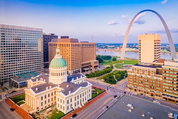
Missouri is a landlocked state in the Midwest that borders eight others, tying with Tennessee for the most border states. It’s also known as the “Show Me State,” the “Cave State,” and “The Mother of the West.”
The area of Missouri has been inhabited for at least 12,000 years, and European settlers arrived in the 17th century. The state was acquired by the United States from Spain in the Louisiana Purchase of 1803. It became the 24th state of the USA in 1821.
Significant contributions to American music have also been made in Missouri. It is said to be the birthplace of the genres’ ragtime, Kansas City jazz, and St. Louis Blues. Chuck Berry, Sheryl Crow, and Eminem are a few renowned musicians from this state.
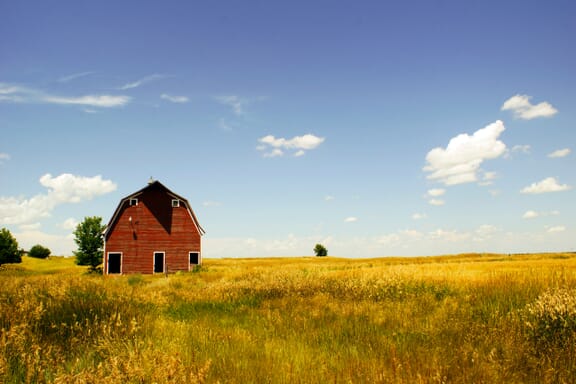
Nebraska is a triply landlocked state in the middle of the United States. It became the 37th state of the USA in 1867, and it was inhabited by indigenous peoples for thousands of years before the arrival of European explorers.
The largest city in Nebraska is Omaha, which is named after the indigenous Omaha people who still reside in the area. The city lies on the Missouri River and is the 39th largest in the country. The capital city of Nebraska is Lincoln, named after President Abraham Lincoln.
The two major geographic regions of Nebraska are the Dissected Till Plains and the Great Plains. Both of these regions experience dramatic temperature changes throughout the year, with hot summers and freezing winters. Treeless prairies and gently rolling hills constitute the majority of the state’s landscape.
Racially, the vast majority of Nebraska’s residents are White (nearly 80%) and the next largest group is Black at about 5% of the population. The state is home to the highest percentage of Czech and non-Mormon Danish Americans in any state, and the largest ancestry group in the state is German Americans.
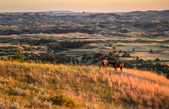
Named after the indigenous Dakota Sioux, North Dakota is located in the Midwestern United States and borders Canada as well as three other states. The city of Rugby, North Dakota is thought to be the geographical center of North America, and the KVLY-TV mast located in the state was once the tallest man-made structure in the world.
Part of the Great Plains Region, the state’s landscape is characterized by prairies, temperate savannas, badlands, and farmland. High-quality soil makes agriculture a major economic resource for the state.
North Dakota is one of the least populated states in the country and has a low population density, although it has seen rapid population growth due to oil extraction efforts offering high-paying jobs. It currently has the second-lowest unemployment rate of any state in the USA.
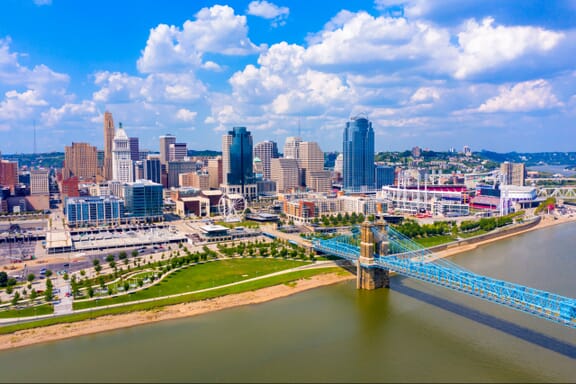
Ohio is the easternmost state within the Midwestern United States, bordering Lake Eerie to its north and five other states. It is the only state in the USA to have a flag that is non-rectangular, and it is known as the “Buckeye State” for the Buckeye trees that grow in the area.
The Ohio Valley has been inhabited for thousands of years; there is evidence of nomadic populations living in the area as early as 13,000 BCE. Various other indigenous peoples inhabited the area in the many years that followed prior to the arrival of European explorers. The state is named after the Ohio River, whose name comes from the Seneca word for “good river.”
Politically, Ohio is a dynamic state. It is known as a “swing state,” one that can vote for either the Democratic or Republican candidates in presidential elections. It’s also known as a bellwether state, one that functions as an indicator of national political trends. Seven different US presidents have come from Ohio, giving it the nickname “the Mother of Presidents.”
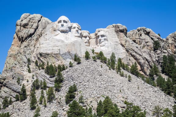
South Dakota is a landlocked state in the Midwestern United States. It became the 40th state to join the USA in 1889, at the same time as North Dakota.
Like its neighbor to the north, South Dakota was named for the Dakota Sioux people that inhabited the land before the arrival of European explorers. There are nine reservations of Lakota and Dakota tribes in the state today, making up a significant portion of the state’s population.
South Dakota is part of the Great Plains region of the United States, and it is divided into two sections by the Missouri River. These two areas have social and geographical differences and are referred to as “East River” and “West River” by residents.
The eastern half of South Dakota is the more populated portion, and many crops are grown here due to the fertile soil. The western half of the state has a higher Native American population and is used for ranching more than crop production. Tourism is also a bigger industry in the western portion of the state.
There are two national parks in South Dakota: Wind Cave National Park and Badlands National Park. The former features an extensive cave network, and the latter boasts a colorful, eroded landscape. Both are located in the southwestern region of the state. The Mount Rushmore National Memorial is also located in the state.Wisconsin
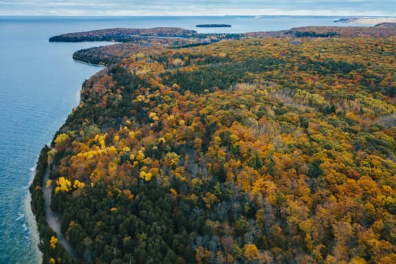
Wisconsin is located in the upper Midwestern United States, bordering Lake Superior and Lake Michigan as well as Minnesota, Illinois, and Iowa. The capital and second-largest city in the state is Madison, and the largest city is Milwaukee.
There are 11 federally recognized Native American tribes that currently live in the state, and the area has been inhabited by indigenous peoples for thousands of years. The Algonquian and Siouan people were living in the area when European settlers arrived, and the name of the state comes from the Algonquian language.
Sometimes referred to as “America’s Dairyland,” Wisconsin is one of the country’s leading dairy producers and is particularly known for its cheese. Beer is another important part of Wisconsin culture, and the Miller Brewing Company headquarters are located in Milwaukee.
Due to glacier movement during the Ice Age and its location between two great lakes and the Mississippi River, Wisconsin’s geography is diverse. There are several types of forests covering about 46% of the state’s land area, thousands of glacial lakes, sandstone formations, ridges, and rich farmlands.